Project P8:
ATMO-DEL: Determination of atmospheric delay by line-of-sight modeling and measurements of tropospheric composition and ionospheric electron distribution
Project overview
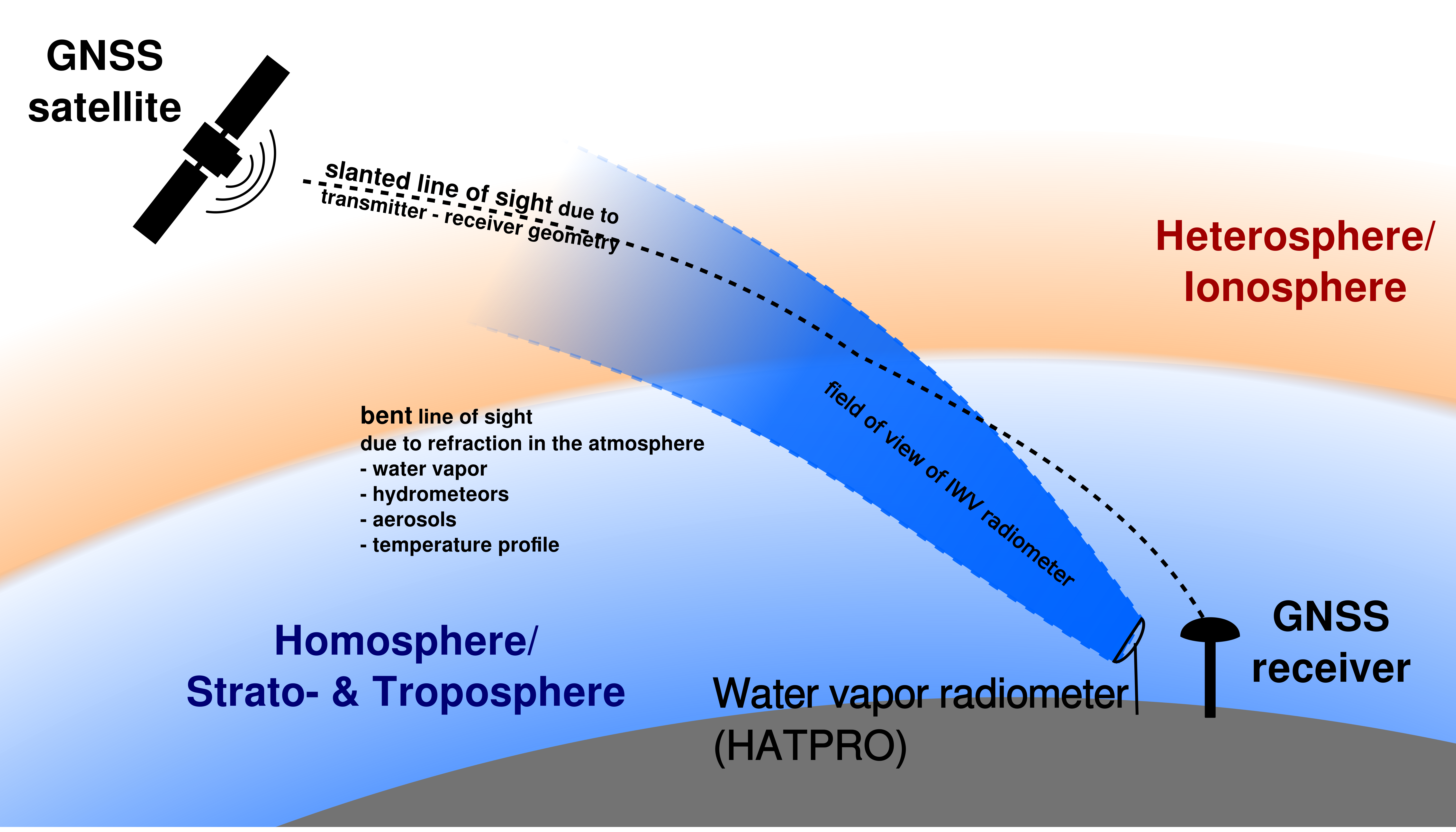
Project P8 of the research unit investigates the quality and feasibility of detailed ray-trace modelling combined with atmospheric measurements and assimilation models. The aim is to determine propagation delays along the actual line of sight between transmitter and receiver, accounting for tropospheric composition and the distribution of ionospheric electrons.
The original objectives have two complementary parts. P8.1 examines how atmospheric conditions, water-vapour structure and clouds affect the delay, including uncertainty propagation to derive the measurement requirements for a positioning goal below 1 mm. P8.2 compares integrated water vapour and liquid-water path from different instruments and evaluates models such as ERA5 around Wettzell. The observatory’s extensive instrumentation makes it a suitable test site.
Why it matters
How accurately must the atmosphere be known to support millimetre-level geodetic measurements?
Once instrumental timing becomes more stable, atmospheric propagation becomes more prominent in the error budget. Independent observations are needed to distinguish directional atmospheric variations from clock and instrumental effects.
Our approach
Line-of-sight ray tracing is combined with scanning water-vapour radiometry and Fourier-transform infrared spectroscopy. The observations help test weather-model descriptions and identify the accuracy required of atmospheric inputs. Tropospheric and ionospheric modelling are being brought together with the measurement-based validation.
Key outcomes
- Implemented a detailed tropospheric ray-tracing model for the propagation delay along individual lines of sight.
- Operated Wettzell’s water-vapour radiometer in scanning mode to generate direction-dependent atmospheric skymaps.
- Initial analyses showed millimetre-level path variations from azimuthal atmospheric inhomogeneity, particularly at low elevations, corresponding to timing effects of a few picoseconds.
- Completed a dedicated Fourier-transform infrared measurement campaign in July 2026. Integration with ionospheric modelling and full measurement-based validation remain in progress.
The work provides independent atmospheric information for closure experiments and common-clock analyses. It also identifies the propagation effects that must be controlled before further clock improvements translate into better geodetic products.