Novel clock technologies for combination on ground and in space:
Real data and simulation (P9)
The goal of project P9 is a highly accurate and long-term stable realization of the International Terrestrial Reference System (ITRS) through a combination of the observations of geodetic space techniques by exploiting the novel clock technologies at the Geodetic Observatory Wettzell (GOW) based on a common target (CT) and a common clock.
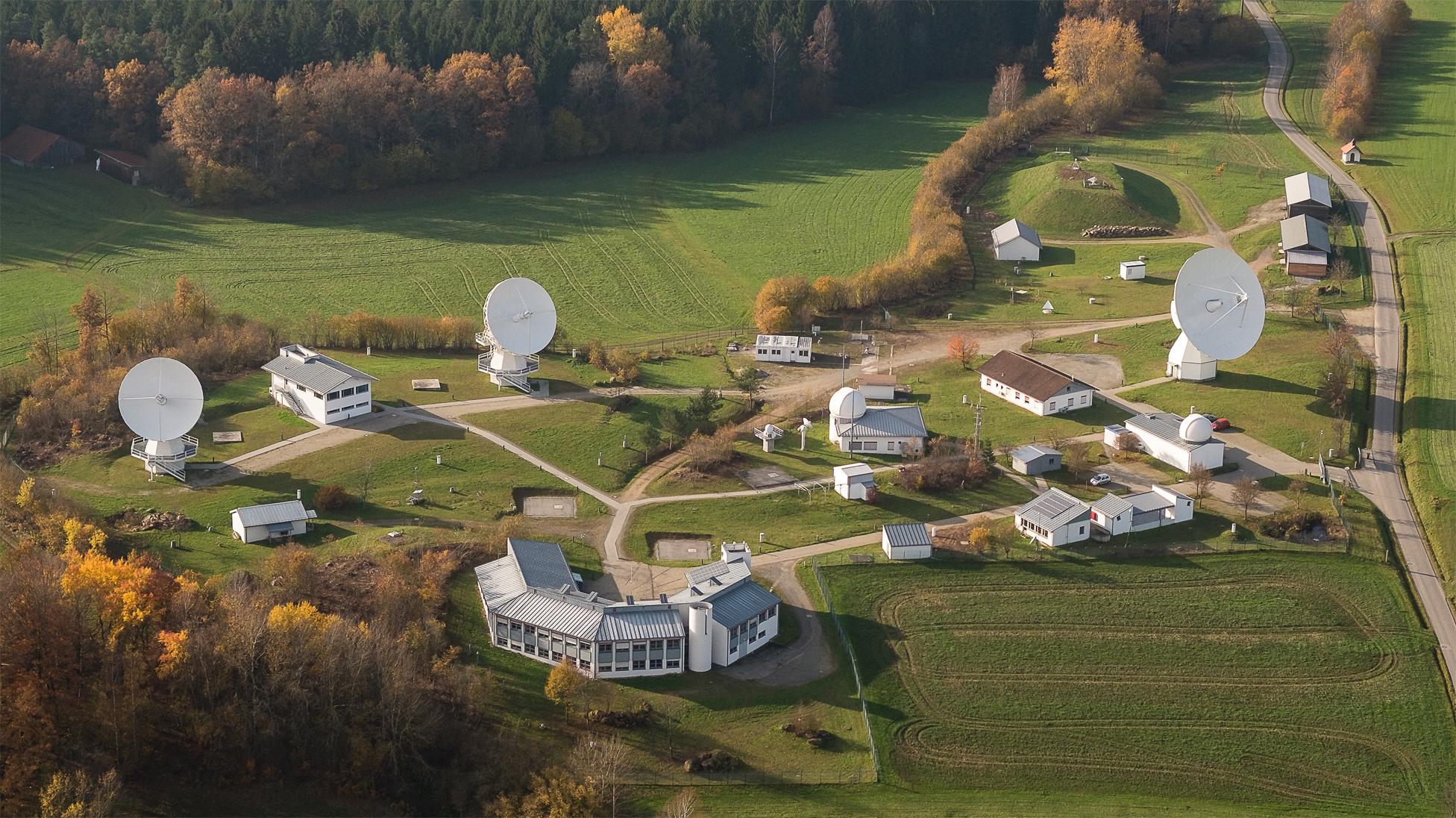
GOW operates all four techniques relevant for the ITRS realization, namely Very Long Baseline Interferometry (VLBI), Satellite Laser Ranging (SLR), Global Navigation Satellite Systems (GNSS), and Doppler Orbitography and Radiopositioning Integrated by Satellite (DORIS). The accuracy of current ITRS realizations, the International Terrestrial Reference Frame (ITRF), is limited by remaining systematics in the analysis and combination of geodetic space techniques and do not meet the Global Geodetic Observing System (GGOS) requirements for high-precision geodetic applications. These are 1 mm accuracy and 0.1 mm/year temporal stability of the ITRF-defining parameters: origin, orientation, and scale.
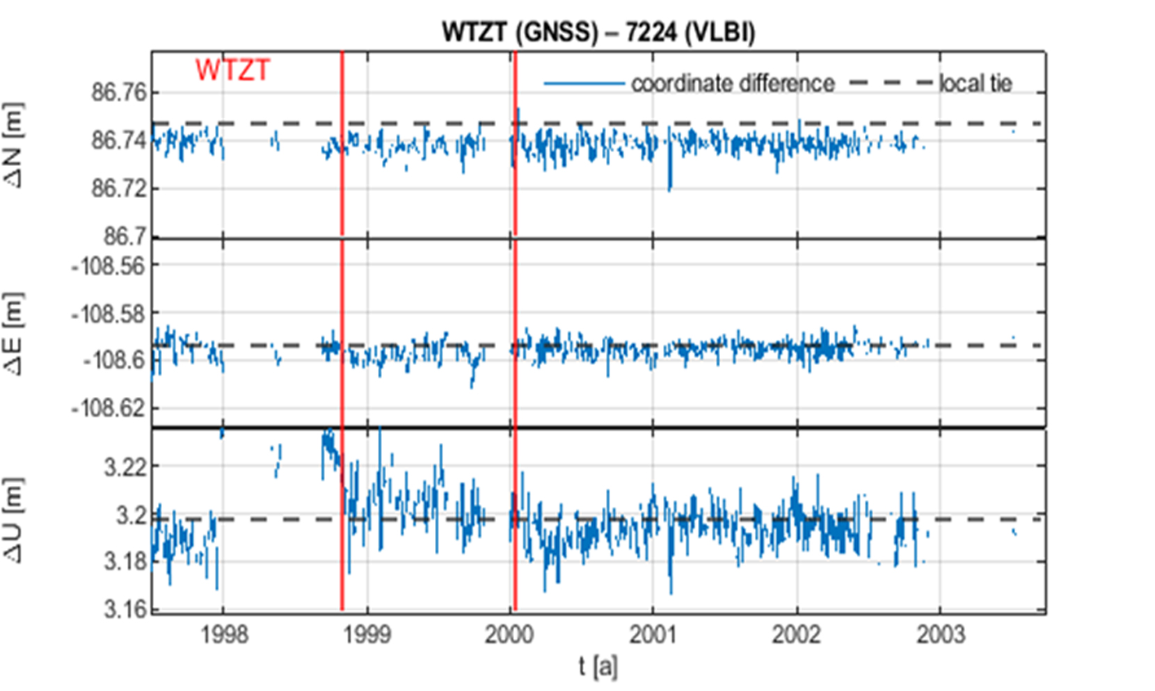
One objective of this project is to identify systematic errors by analyzing and comparing long observation time series of the techniques as well as high-accuracy calibration data of the individual instruments obtained using the new clock technologies. In an iterative process with projects P6 and P7 of the RU, these systematic errors are reduced. It is aimed to achieve an almost error-free combination of the four techniques at GOW, taking into account both station coordinates and time parameters. Research is based on real observation data of GOW. Furthermore, to demonstrate the benefit of a nearly error-free combination on the ITRF, simulations of observations from globally distributed stations are performed. These simulations mirror the performance of GOW and involve observations to prospective satellites that co-locate the four techniques. In addition, P9 entails the development of the theoretical framework for integrating observed time differences between stations as observables in the observation equations of the different techniques. P9 is jointly carried out by DGFI-TUM and the University of Bonn.
Publications:
-
Seitz M., Bloßfeld M., Angermann D., Glomsda M., Rudenko S., Zeitlhöfler J., Seitz F.: DTRF2020: ITRS 2020 realization of DGFI-TUM (data). Zenodo, 10.5281/zenodo.8220524, 2023
Presentations:
- Glaser S., Schreiner P., Raut S., Reinhold A., Brockmann JM. Next-generation GNSS and innovative combination strategies. Presented at: FGS Workshop; June 26, 2024; Bad Kötzting, Germany.
- Reinhold A., Glaser S., Kehm A., Seitz M. On simulations studies for novel combination strategies of space geodetic techniques. Presented at: FroGS; September 26, 2024; Stuttgart, Germany.
- Reinhold A., Glaser, S., and Seitz, M.: On simulation studies for novel combination strategies of space geodetic techniques, EGU General Assembly 2025, Vienna, Austria, 27 Apr–2 May 2025, EGU25-1646, https://doi.org/10.5194/egusphere-egu25-1646, 2025.
- Glaser S., Reinhold A., Klug J. and Seitz M.: On simulation studies of space geodetic techniques for innovative combination strategies, IAG Scientific Assembly 2025, Rimini, Italy, 1-5 September 2025