Project P8 of the research unit investigates the quality and feasibility of detailed ray-trace modeling combined with state-of-the-art measurements and assimilation models. Ray-trace modeling is used to specify the detailed path along the line-of-sight. The objective of P8 is divided into two parts:
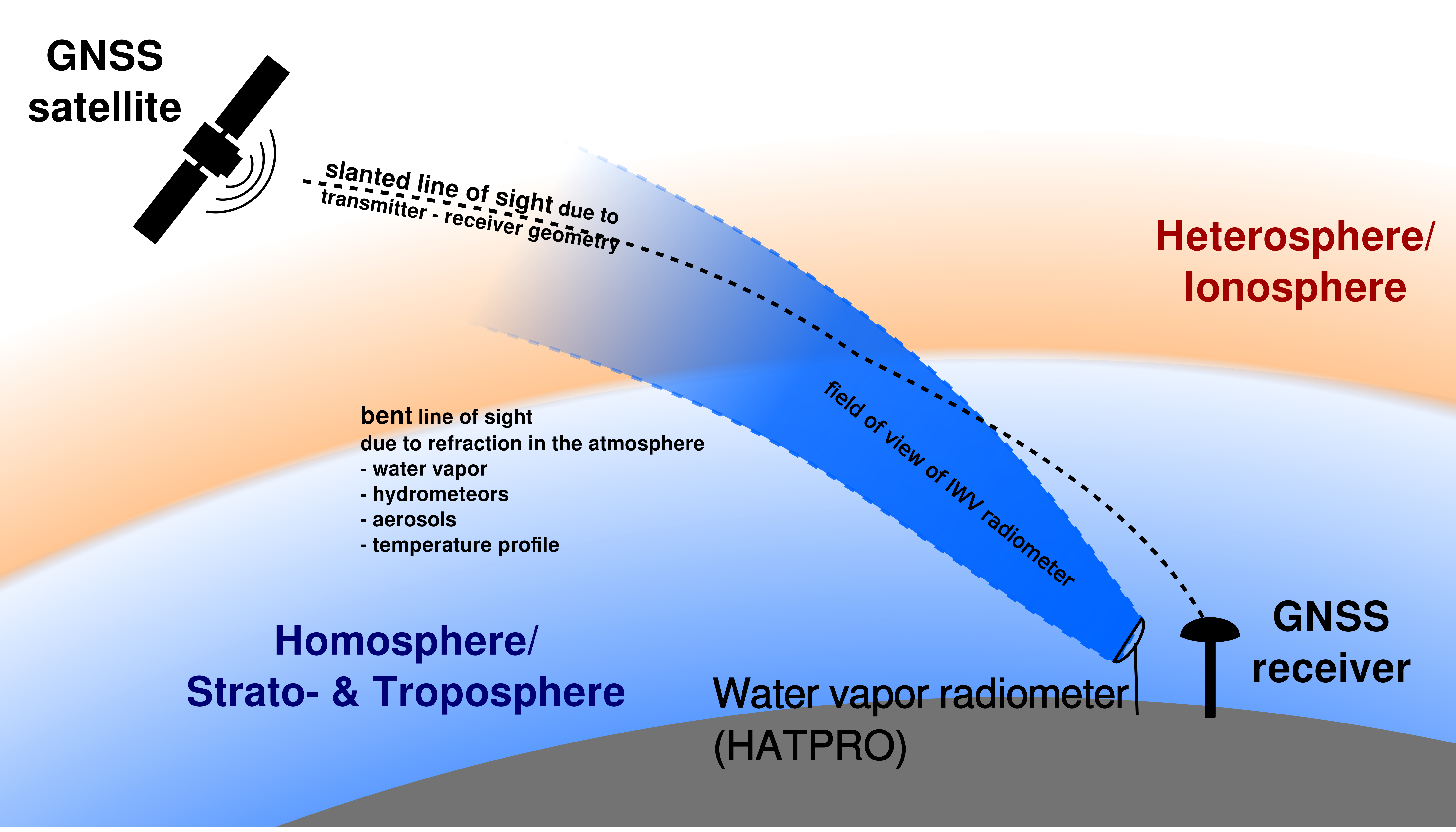
Objective P8.1: The effect of atmospheric conditions and composition on the atmospheric delay along the line-of-sight from the receiver to the transmitter will be evaluated. This includes detailed error propagation to estimate the accuracy and precision for the atmospheric measurements, which is required in this project (uncertainty in positioning less than 1 mm). It also used to investigate of how good we need to know the atmosphere to fulfill the aims of the research unit, e.g. structure of the water vapor load, structure of clouds.
Objective P8.2: Integrated water vapor (IWV) and the liquid water path (LWP) measured using different techniques will be evaluated and used to investigate the feasibility of atmospheric models, e.g. ERA5, to model the atmosphere around the Geodetic Observatory Wettzell (GOW). The GOW is a reference station for GNSS observations run by the Bundesamt für Kartographie und Geodäsie (BKG) in cooperation with the Technische Universität München (TUM). The GOW is very well suited for the program outlined in this project, because of its extensive instrumentation and its role as a reference station for GNSS applications.